Hurricane warning covers remote Hawaiian atolls in Lala's path
Waves are expected to wash over low-lying reefs, four days after Lala's rains flooded the Big Island. Forecasters are watching two more Pacific systems.
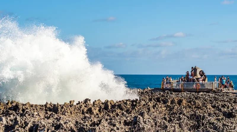
A hurricane warning covers part of the remote Northwestern Hawaiian Islands as Hurricane Lala tracks northwest across open water, four days after the storm's rains flooded Hawaii's Big Island and cut power across the state. Forecasters are watching two more areas of the Pacific for tropical development.
These large waves will likely inundate some of the low-lying atolls, especially from French Frigate Shoals to Maro Reef.
The Central Pacific Hurricane Center put Lala's maximum sustained winds at 125 mph at 5 a.m. Hawaii time on August 19, a Category 3 hurricane about 275 miles south of Maro Reef. A hurricane warning is in effect for the Papahanaumokuakea Marine National Monument from Lisianski Island to Maro Reef, and a tropical storm warning east of Maro Reef to French Frigate Shoals. Forecasters said Lala has reached its peak intensity and should weaken as it tracks away from the main Hawaiian Islands.
Two systems under watch
In an outlook issued at 5 a.m. Pacific time on August 19, the National Hurricane Center said an area of low pressure is forecast to form several hundred miles south-southwest of southern Mexico around the end of the week. Gradual development is likely afterward, with a tropical depression expected over the weekend as the system moves west-northwestward and stays well offshore. The center put the chance of formation at 80 percent over seven days and near zero over 48 hours.
The second system is closer. A tropical wave well east-southeast of the Hawaiian Islands is producing a large area of showers and thunderstorms with some signs of organization, and the hurricane center said a tropical depression is likely to form within a couple of days as it moves west into the Central Pacific. Formation odds there are 70 percent over 48 hours and 80 percent over seven days.
Hurricane conditions are expected inside the warning area by August 20 and tropical storm conditions on the night of August 19, the hurricane center said. Hurricane-force winds extend up to 30 miles from Lala's center and tropical-storm-force winds up to 115 miles.
Neither of the two developing systems threatens land. The hurricane center expects both to stay over open water as they organize.
What Lala left behind
Lala passed just south of the Big Island on August 15 as a Category 1 hurricane, its northern eyewall brushing South Point while the center stayed within 50 nautical miles offshore, according to the hurricane center. It never made landfall. Hawaii island police said the body of May Doi, 93, of Naalehu was found on August 17. A preliminary investigation indicated her death appeared to be related to the storm, police said, and an autopsy is pending.
Governor Josh Green put preliminary damage at 100 or more homes on the southern Big Island, with no county structural count yet released. The National Weather Service recorded 43.55 inches of rain at Laupahoehoe, on the island's northeast coast, from August 14 to 16, with rain falling at 3 to 5 inches an hour in places. Landslides and flash floods cut roads and swept at least one house off its foundation.
| Oahu | 173,900 |
| Hawaii County | 50,800 |
| Maui County | 26,200 |
As filed
More than 255,000 customers across all utilities were without power at that hour, according to the Hawaii State Energy Office. Hawaiian Electric warned that some customers in rural parts of the Big Island could be out for weeks or months, after high winds damaged a major transmission line and several sub-transmission lines and cut four independent power producers off the grid. Kauai is served by the Kauai Island Utility Cooperative, which reported about 4,500 members out at the same hour.
Saturated ground left a landslide risk on steep terrain for a day or two after the rain eased. The weather service had issued a life-threatening flash flood emergency for the Kau District, including Naalehu, Pahala and Hawaiian Ocean View. The state Department of Health issued a statewide brown water advisory telling people to stay out of discolored coastal water and streams, where storm runoff can carry contamination, and precautionary boil-water notices for two Kau water systems.
Warm water fed the storm
Flooding, and the mud and rock it carried, caused most of the destruction across the island's south. Wind damage was lighter.
Storms approaching Hawaii usually weaken over cooler water before they arrive. Lala did not. Sea surface temperatures along its track ran about 3 degrees Fahrenheit above average, according to Weather.com.
The Climate Prediction Center has an El Nino advisory in force. It said on August 13 that El Nino is strengthening, with a greater than 90 percent chance of a very strong event during the Northern Hemisphere fall and winter of 2026-27. The Nino-3.4 index stood at plus 1.4 degrees Celsius in July.
The same pattern has worked the other way in the Atlantic. High wind shear associated with El Nino has suppressed formation there, and the hurricane center's Atlantic outlook of August 18 listed no active systems and none expected over the following seven days.
Lala is the first Central Pacific tropical cyclone of 2026, designated CP01. It became a tropical storm on August 13 after forming from a disturbance near the boundary between the Eastern and Central Pacific.
How the storm ranks
Lala was the fifth hurricane since 1957 to pass within 70 miles of the Big Island, according to Weather.com, citing NOAA's historical hurricane tracks database. The others were Hone in 2024, Douglas in 2020, Iselle in 2014 and Kanoa in 1957. On preliminary rainfall totals Lala would rank as the third-wettest tropical cyclone recorded in Hawaii, behind Lane in 2018 and Hiki in 1950, though the weather service has not certified the figures.
Lala weakened to a tropical storm as it scraped the island's terrain, then pulled away and intensified over open water. It was a 70 mph tropical storm at 5 p.m. Hawaii time on August 17, reached Category 4 strength with 130 mph winds late on August 18, and had eased to 125 mph by the following morning.
Recovery in its early stages
Green signed an emergency proclamation on August 13, activating the state's major disaster fund and authorizing the National Guard. More than 240 Guard personnel deployed statewide. County fire crews and police searched Naalehu and Waiohinu, joined later by Guard search and extraction teams, while the Coast Guard flew in supplies and airlifted a Guard response unit from Oahu. Green said crews carried out numerous water rescues, including one of a woman whose house was swept away by floodwater.
State and county offices, schools and courts closed statewide on August 17 and remained shut on the Big Island on August 18, Green said, citing damage to schools and widespread power failures. Public schools reopened on August 19, except Naalehu Elementary, which is closed through August 20.
What the forecasts do not say
The formation chances the hurricane center publishes are probabilities, not tracks. An 80 percent chance says only that a system is likely to form. It does not say where it will go or how strong it will get, and the figures move between issuances: the odds on the Central Pacific wave rose from 50 percent to 70 percent over 48 hours in the space of a day.
The center has not forecast a track toward land for either developing system. Its Lala forecast runs through the weekend, and it expects the storm to remain a hurricane over that period while weakening from its peak.
Power had been restored to most of the state by August 17, with fewer than 400 customers still out on Kauai, though Hawaiian Electric said the hardest-hit rural areas of the Big Island would take far longer.
Lala is now several hundred miles northwest of the main islands and moving away from them. The two developing systems remain over open water, hundreds of miles from any coast.
Days of watching ahead
A tropical depression is likely to form from the tropical wave near Hawaii within a couple of days, and from the system near Mexico over the weekend, the hurricane center said. Whether either becomes a named storm, and where it goes, depends on conditions forecasters are still tracking over the open Pacific.
Sources for this article
10 sources · Retrieved 19 Aug 2026
- 1National Hurricane Center: Graphical Tropical Weather Outlook, Eastern and Central Pacific
- 2Newsweek: New Hurricane Threats Grow in Pacific Days After Lala's Destruction
- 3Newsweek: When Next Hurricane Could Form as Hawaii Recovers from Lala
- 4Fox Weather: The Pacific is showing new signs of tropical activity as Lala moves away
- 5CNN: At least one dead and over 100 homes damaged in wake of Hurricane Lala
- 6ABC News: Lala spins out to sea after storm hammered the Hawaiian Islands
- 7Tech Times: Hurricane Lala Shattered Pacific Records While El Niño Strangled Atlantic
- 8Wikipedia: Hurricane Lala
- 9Hawaii News Now: Power outages impact over 197K in Hawaii as Lala hampers utility crews
- 10The Inertia: Two more storms are brewing in the Pacific after Hurricane Lala
More from Threadline News
 WorldHaiti extradites 18 suspects in Moïse assassination to U.S.21 Sep 2026
 WorldShark kills swimmer off Perth's Sorrento Beach18 Sep 2026
 WorldNTSB to analyze live broadcast video from LA helicopter crash17 Sep 2026
 WorldMalawi police offer K30 million reward for abducted Nusrat Osman15 Sep 2026
 WorldBrianna Cronin, 29, dies in fall at Bali's Kelingking Beach14 Sep 2026
 WorldItalian police report calls ambulance driver Luca Spada a serial predator11 Sep 2026
The Numbers
AllOfficial series, each dated to the observation it comes from.
Federal Reserve Bank of St. Louis